

158 kilometers, 8,767 meters of elevation gain, 12 days of trekking, 54 hours of moving time – and countless moments that took my breath away.
That’s how you could sum up my journey through one of the most stunning and challenging trekking circuits in Nepal – a combination of the Everest Base Camp trek, the ascent of Gokyo Ri, and the crossing of Cho La Pass.
This route is more than just walking trails – it’s a journey into a world where glaciers touch the sky, where villages perch among the clouds, and where every breath at 5,000 meters becomes a memory.
Trek Overview:
- Duration: 12 days
- Distance: 158.16 km
- Total elevation gain: 8,767 m
- Highest point: Kala Patthar – 5,645 m
- Longest day: Namche Bazaar – Lukla, 19.45 km
- Toughest day: Crossing the snow-covered Cho La Pass (5,420 m)


After barely an hour of sleep (if I’m being generous 😅), Kishwar from Breeze Adventures picks us up at Kathmandu airport. The city greets us with a mix of dust, honking horns, and the chaos of a million things happening at once. We check into our hotel, freshen up quickly, and head straight out to explore the Monkey Temple – Swoyambhu Mahachaitya. Steep stone steps lead us up past watchful monkeys, the air thick with the scent of incense and the sound of prayer wheels spinning.
That evening, we grab dinner, but there’s no time to really settle – at 12:30 a.m., we’re already in the van heading to Ramechap airport. The “road” feels more like an obstacle course. A huge section was washed away by floods in 2024, so progress is painfully slow – over five hours for just 130 km. We reach the airport at 6:30 a.m., only to wait until 9:40 for our flight to Lukla.
Day 1 – Kathmandu → Ramechap → Lukla → Phakding
- Distance: 9.3 km
- Elevation gain: 299 m
- Moving time: 2h 50m

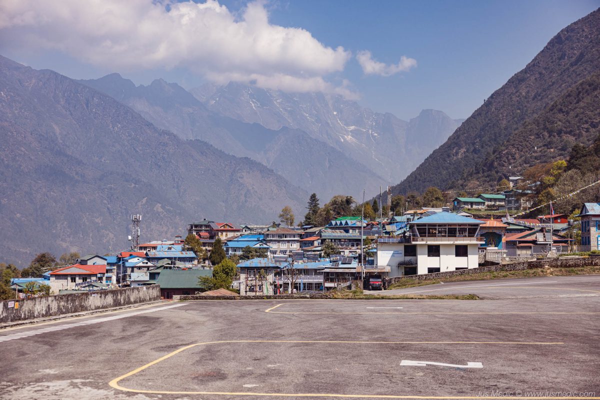
Landing at Lukla airport – often called the most dangerous airport in the world – instantly sets the tone for the adventure. The short, sloped runway carved into the mountainside is as thrilling as it is nerve-wracking. From Lukla, the trail meanders through small Sherpa villages and across swinging suspension bridges, decorated with colorful prayer flags dancing in the wind. The air is crisp, the path relatively gentle, and the constant soundtrack of the Dudh Koshi River sets a calming pace for the first day.
Phakding, a small riverside settlement, offers the first taste of trekking lodge life – warm tea, a simple meal, and the hum of fellow trekkers sharing their plans and excitement.


Day 2 – Phakding to Namche Bazaar
- Distance: 10.52 km (+100 m climb to upper Namche)
- Elevation gain: 962 m (+100 m extra)
- Moving time: 4h 37m

The second day is where the real climb begins. Leaving Phakding, the trail winds deeper into the valley before hitting the first big suspension bridge – the iconic Hillary Bridge – hanging high above the roaring Dudh Koshi River. Colorful prayer flags flutter in the wind, and the sheer drop below makes every step memorable.
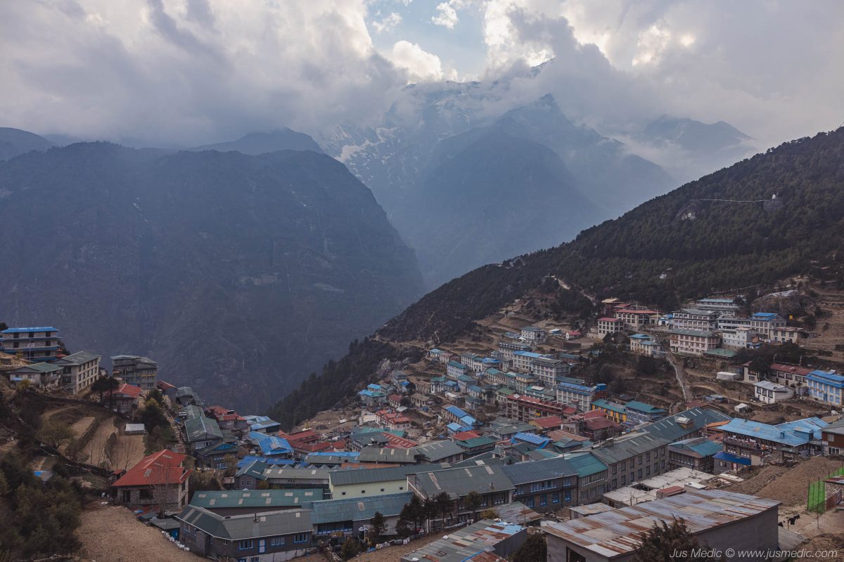
From there, it’s a relentless uphill push to Namche Bazaar, the gateway to the Khumbu region. The climb is tough, but every pause to catch our breath rewards us with increasingly stunning views of the surrounding peaks and deep valleys.
Arriving in Namche feels like stepping into a mountain metropolis – a bustling hub of trekkers, guides, tea houses, bakeries, and gear shops. The narrow streets are alive with chatter in a dozen languages. I even added an extra 100 m climb to the upper part of town for a better panoramic view – and to give my lungs and legs one last challenge before calling it a day.


Day 3 – Acclimatization in Namche Bazaar
- Distance: 7.7 km
- Elevation gain: 520 m
- Moving time: 2h 50m

Acclimatization days are meant to prepare your body for higher altitudes — and sometimes they also test your patience with the weather. The morning hike to the Everest View Hotel was wrapped in thick clouds, hiding the peaks we had hoped to see. The air felt heavier at 3,880 m, each step a reminder of why these days are so important.
Still, the mountains gave us a small gift. From the Everest View Point near the Sherpa Culture Museum, the clouds drifted just enough to reveal a fleeting view of Lhotse and the mighty Everest. A short but special glimpse — as if the Himalayas were reminding us they decide when to show themselves.
The rest of the day was slow and easy. We wandered through Namche’s winding streets, browsed small gear shops, sipped coffee at a local café, and let the energy of the bustling market town sink in. It felt like the calm before the climbs ahead.

Mt. Everest and Lhotse


Day 4 – Namche Bazaar → Dole (4,070 m)
- Distance: 13.32 km
- Elevation gain: 1,091 m
- Moving time: 4h 55m

Leaving Namche, we take a less-traveled route toward Dole. The trail first leads us through patches of pine forest and juniper, the morning air cool and fresh. After a steady climb, we reach the first high point at around 3,980 m, where we stop for tea and take in the sweeping views.
From there, the path drops sharply into a valley at 3,600 m, where we have lunch surrounded by rhododendrons and the sound of a nearby stream. The respite doesn’t last long — what goes down must come back up. The climb back out is steep, winding through rhododendron forests and into open terrain dotted with hardy alpine plants.
By late afternoon, we arrive in Dole at 4,070 m, a small cluster of lodges perched above the valley. The temperature drops quickly, and by evening snowflakes begin to fall. Inside, the warmth of the lodge fills with laughter as our guide and Sherpas teach us a local card game, Call Break. Outside, the snow settles quietly — a reminder that we’re climbing deeper into the high Himalayas.
Dole, at 4,070 m, is quieter than the EBC route – the first taste of the more remote Gokyo Valley.


Day 5 – Dole → Machermo (4,400 m)
- Morning trek: 6.17 km, 470 m gain, 2h 04m
- Afternoon acclimatization hike: 3.79 km, 322 m gain (to 4,666 m), 1h 10m

We wake to a crisp, crystal-clear morning — the kind of day that promises big views. After breakfast (fried eggs, the classic), we set off at an easy pace, stopping often for photos. The trail climbs gently, opening up to sweeping panoramas of jagged ridges and snow-capped peaks.
Ahead, Thamserku rises like a fortress of ice, and for the first time, Cho Oyu — the sixth-highest mountain in the world at 8,188 m — appears on the horizon. Its massive white summit glows against the deep blue sky. We pause for a while, letting the sight sink in, snapping a few shots to mark the moment.
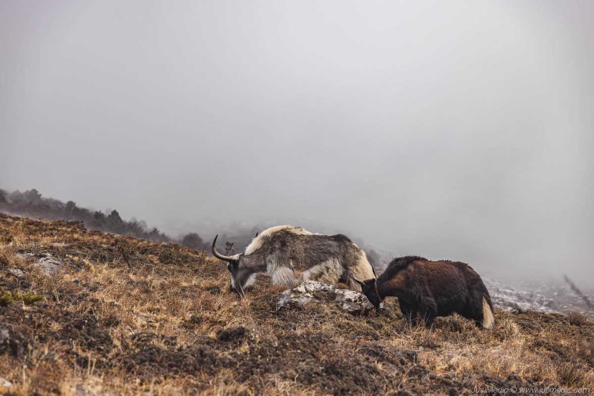
The path takes us through the tiny hamlet of Luza, where a few yaks graze lazily, their bells clanging softly. They’re surprisingly photogenic, posing as if they know they’re part of the scenery. We’re not tired yet, so we keep going until Machermo comes into view — a small, wind-sheltered village tucked beneath the mountains. Even though it’s –1°C, the sun is so strong we end up in short sleeves and sandals outside the lodge.
In the afternoon, we take a short acclimatization hike up a nearby ridge to just under 4,700 m. The air is thin, but the reward is a quiet, commanding view over the valley. As evening falls, we return to the lodge for dinner, a few rounds of cards, and an early night. Tomorrow, we’ll reach Gokyo.


Cho Oyu – 8.188m


Day 6 – Machermo to Gokyo + Glacier Hike
- Morning trek: 7.78 km, 543 m gain, 2h 37m
- Afternoon glacier hike: 2 km, 220 m gain, 25 min x2

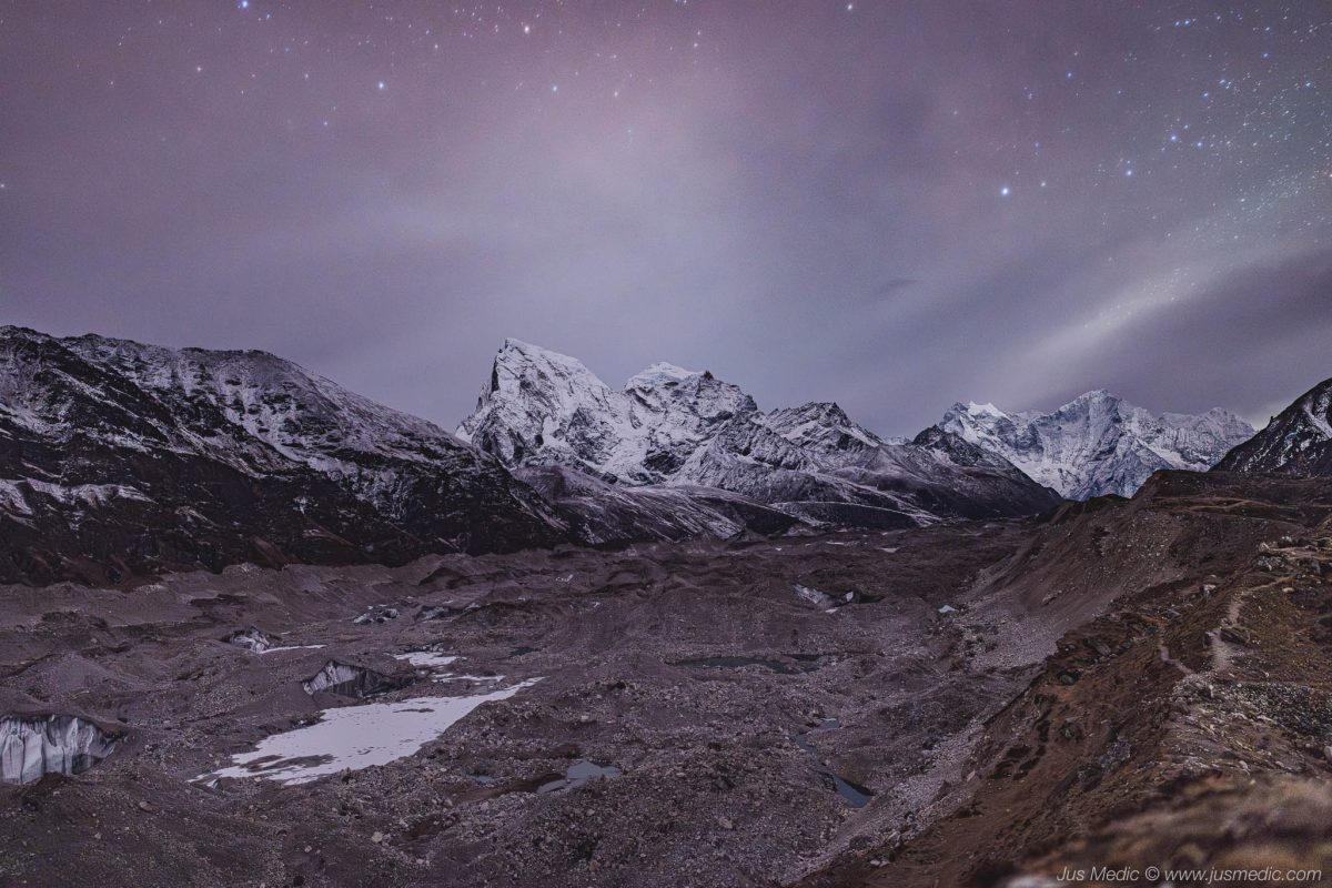
We leave Machermo under a bright, windless sky, the kind of morning where every peak looks impossibly close. The trail climbs steadily at first, then drops into a small valley before tilting upward again toward the largest glacier in the Himalayas — Ngozumpa Glacier.
As we approach the lateral moraine, the path turns into a staircase of rough stone. The climb is short but steep, our breath quickening in the thin air. Cresting the rise, the first of the Gokyo Lakes appears — a jewel of turquoise water set against a backdrop of rock and snow. It’s so still it feels almost unreal.
We keep going, passing the second lake shimmering under the midday sun. Finally, the third lake comes into view, and with it the village of Gokyo, a scattering of lodges huddled at the water’s edge. We settle into our lodge, have a late lunch, and try to rest — tomorrow’s climb to Gokyo Ri will be an early one.
By mid-afternoon, light snow begins to fall, softening the edges of the peaks. When it finally stops, we head out for a short acclimatization hike to the edge of the glacier’s moraine. The climb rewards us with a sweeping view over the frozen chaos of ice and rock, and the distant peaks glowing in the late light.
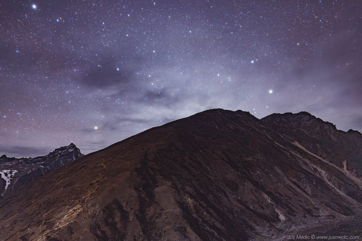
That evening, while the village sleeps, I retrace the same path alone under the stars. The air is sharp and still, the crunch of my boots the only sound. From the moraine, the glacier is a dark, silent sea, and the night sky is so clear it feels infinite. I set up my camera, taking long exposures until the cold finally pushes me back toward the warmth of the lodge.


Day 7 – Gokyo Ri (5,357 m) → Dragnag (4,700 m)
- Gokyo Ri ascent: 5.06 km, 568 m gain, 2h 26m
- Trek to Dragnag: 4.47 km, 220 m gain, 1h 44m

The alarm cuts through the cold at 4:00 a.m. We layer up, headlamps carving narrow cones of light in the darkness, and begin the climb to Gokyo Ri. The air is thin and the slope unrelenting — two solid hours of steady ascent. Behind us, the horizon lightens slowly, a pale glow hinting at the coming day.
At the summit, the view is softened by clouds. The distant giants — Everest, Lhotse, Makalu — stay hidden, but the closer peaks stand clear and sharp against the sky. The vast spread of the Ngozumpa Glacier lies below us, its twisted surface of ice and rock stretching away into the mist. Even without the full panorama, the moment feels immense — the silence, the thin air, and the raw presence of the mountains around us.
After a few photos and a quiet pause at the top, we descend for breakfast back at the lodge. By late morning, we shoulder our packs and set off across the Ngozumpa Glacier toward Dragnag. The crossing begins in calm weather, but halfway through, snow starts to fall and a biting wind whips across the ice. The glacier is a maze of uneven surfaces — loose rock, hard ice, and sudden climbs up and down the moraine. At times, the path narrows with steep drop-offs on either side.
Eventually, we climb the final ridge of the lateral moraine and drop into the valley on the far side. Dragnag is just 20 minutes away, a small, wind-sheltered cluster of lodges at the foot of the mountains. By the time we arrive, the snow has stopped and the clouds are breaking apart. We stand outside in down jackets, letting the last rays of the day warm our faces as the fresh snow melts from the rooftops.
Inside, the evening is quiet — steaming mugs of tea, layers of blankets, and the knowledge that tomorrow will bring the long, steep climb over Cho La Pass.


Day 8 – Dragnag → Cho La Pass (5,420 m) → Dzongla (4,830 m)
- Distance: 11.08 km
- Elevation gain: 793 m
- Moving time: 4h 18m (6h 34m total)

We wake before dawn, the cold biting even inside the lodge. At 5:00 a.m., breakfast is quick — we want to be on the trail early. Outside, the sky is clear and cloudless, the kind of morning that promises both beauty and challenge.
The first two hours are a steady climb through a frozen valley, the crunch of snow underfoot the only sound. The air is crisp, our breath turning to clouds in the frigid air. Eventually, the path opens onto a broad, flatter section, and from here we catch our first glimpse of the pass itself — a steep, jagged wall of rock and snow that looks, at first glance, almost impossible to cross.
Clouds begin to gather at the ridgelines, so we push harder, hoping to stay ahead of the weather. The final ascent is brutal — a mix of rock, ice, and snow, with sections steep enough to demand hands as well as feet. My lungs burn, my legs protest, and for a few moments it feels like I might run out of steam entirely. But the pull of the summit keeps me moving.
When we finally crest Cho La Pass at 5,420 m, the views are fleeting — clouds drift in and out, sometimes revealing nearby peaks, sometimes wrapping the world in white. We take a few photos, share a quick congratulatory handshake, and begin the descent before the snow softens in the sun.
The way down starts on the glacier itself, a slow, careful walk across ice and crevasses. Then the trail drops steeply into the valley, a demanding two-hour descent on loose rock and snow. By the time Dzongla comes into view, the clouds have thickened, hiding Ama Dablam’s summit but leaving her lower slopes visible, draped in fresh snow.
We reach the lodge tired but satisfied — one of the most challenging days of the trek now behind us.

Cho La pass in the distance


Ama Dablam
Day 9 – Dzongla → Lobuche → Gorak Shep → Everest Base Camp (5,364 m) → Gorak Shep
- Morning trek: 11.96 km, 522 m gain, 3h 43m
- Afternoon EBC hike: 7.57 km, 256 m gain, 2h 52m

We wake to a cold, perfectly clear morning. Fresh snow has dusted the ground overnight, and Ama Dablam stands close, her summit now fully revealed against a pale blue sky. The day ahead will be long — maybe the longest of the trek — and we set off early, following the trail high above Chola Lake, which glistens far below with only a thin line of water showing through the ice.
The path bends left toward the Khumbu Glacier, winding gently upward until we reach Lobuche. It’s still early, and the village is quiet; most trekkers begin their day here, so for a while we have the trail entirely to ourselves. From here, the route changes — the flat stretches end, and a steady climb begins, following the glacier’s edge toward Gorak Shep. Helicopters buzz overhead every few minutes, ferrying supplies and shuttling trekkers back to lower altitudes.
At Gorak Shep, we pause just long enough for a quick lunch — 12 km and five hours already behind us — before heading for the crown jewel of the day: Everest Base Camp. The trail undulates over rough moraine, weaving between boulders and ice, always trending upward. The final stretch feels endless, but then, suddenly, there it is — the famous stone marker, a cluster of prayer flags, and the vast Khumbu Icefall rising beyond.
The weather begins to shift, sun giving way to light snow and low cloud, but we still manage our photos before the crowds swell. A nearby expedition guide invites us into their camp for a look around — we even get to try crossing a practice ladder over a crevasse.
The return hike to Gorak Shep feels twice as long. Fatigue sets in, and each rise in the trail tests our patience. By the time we finally drop our packs in the teahouse, we’ve covered nearly 20 km at altitudes above 5,000 m. Dinner is a quiet affair; exhaustion has dulled our conversation. We crawl into our sleeping bags early — tomorrow’s sunrise on Kala Patthar will come far too soon.


Gorak Shep with Kala Patthar in the back (brownish peak) and Pumori 7165m in the background


Day 10 – Gorak Shep → Kala Patthar (5,545 m) → Lobuche → Pheriche → Shomare
- Kala Patthar ascent: 4.50 km, 445 m gain, 2h 27m
- Gorakshep to Periche: 12.71 km, 106 m gain, 3h 29m
- Periche to Shomare: 4.04 km, 57 m gain, 1h 06m

The alarm goes off at 4:00 a.m., but I’m already half-awake, shivering in the cold. Outside, the stars are sharp and countless, the air biting at any exposed skin. Headlamps flicker along the trail ahead as we begin the slow climb toward Kala Patthar.
The slope is steady and steep, our pace deliberate in the thin air. I stop now and then to take photos, catching the faint glow building behind the jagged peaks. Halfway up, the first rays of sunlight hit the Khumbu Icefall, turning the ice a deep gold. Then, through a gap in the mountains, Everest appears — massive, black against the fiery horizon.
At the summit, the wind is sharp but the feeling is pure elation. We’ve reached the highest point of our trek, with 360° views over the giants of the Khumbu. Even a stray mountain dog has followed all the way up, curling in the sun as if he’s done this climb countless times.
After soaking in the moment, we descend quickly to Gorak Shep for breakfast, then shoulder our packs for the long way down. The trail retraces past Lobuche and the Everest Memorial — rows of chortens and plaques honoring those who never came back from these mountains. From there, we drop into Thukla and continue toward Pheriche, where the weather turns. First snow, then rain, and the path becomes slick.
We stop for lunch in Pheriche, warming up just enough to decide to push on to Shomare — another 4 km, but with better lodging, lower altitude, and the promise of deeper sleep. By the time we arrive, every step feels heavy. The relief of a hot meal, a warm bed, and the knowledge that we’re well on our way back down is hard to describe.

Climbers going through the Khumbu icefall


Ama Dablam


Pumori and Kala Patthar


Periche in the distance
Day 11 – Shomare → Namche Bazaar (3,440 m)
- Distance: 16.74 km
- Elevation gain: 594 m
- Moving time: 4h 19m (5h 31m total)

Morning comes with clearer skies and the comfort of lower altitude. After breakfast, we follow the trail toward Pangboche, the village’s stone houses clustered around fields and prayer walls. The path winds gently at first, with views of Nuptse and Lhotse still visible in the distance.
We pass through Deboche, a quiet stretch of forest and prayer flags, before the trail tilts upward toward Tengboche. The monastery here is one of the most important in the Khumbu, its white walls and golden roof set against a backdrop of snow peaks. Monks in crimson robes move quietly between buildings, and the smell of incense drifts from the prayer hall.
From Tengboche, the trail drops steeply into the valley, losing hundreds of meters in minutes. At the river crossing, we pause briefly before starting the long climb back up the opposite side — the final real ascent before Namche.
Clouds are starting to gather, so we push the pace. The trail narrows, weaving through pine forest until suddenly the town appears below. We reach Namche just as the sky opens, heavy rain drumming on the rooftops. Safe and dry, we settle into a café, order pizza and a cold beer, and celebrate — we’re almost at the finish line.


Tengboche monastery


Day 12 – Namche Bazaar → Lukla (2,860 m)
- Distance: 19.45 km
- Elevation gain: 717 m
- Moving time: 5h 45m (6h 54m total)

The rain from the night before hasn’t fully passed. The air is damp, the clouds hang low, and the trail is slick. This last stretch to Lukla is long — about 20 km — and though it’s mostly downhill, the wet conditions make it slow going.
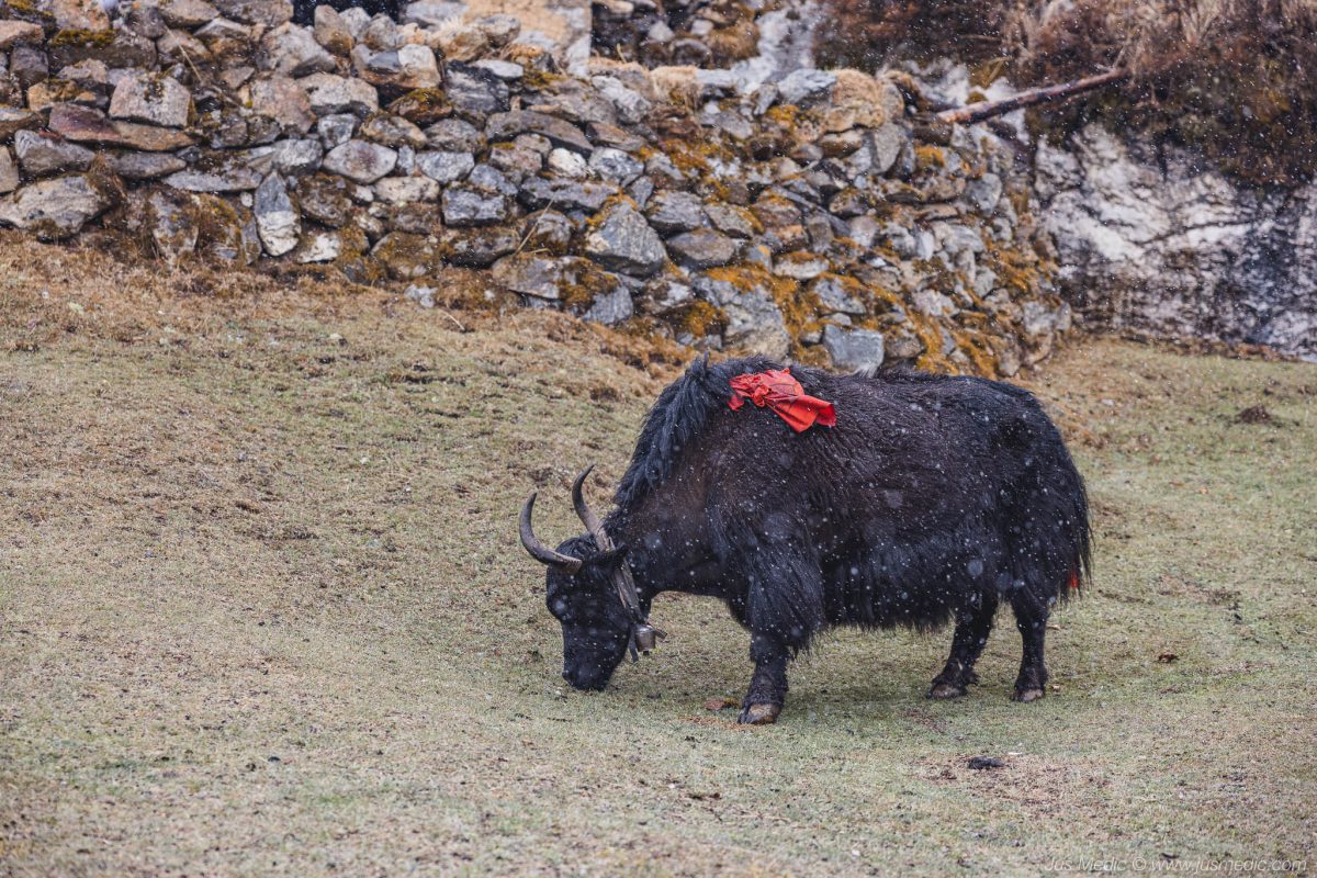
The forest smells of pine and wet earth. We pass yak trains laden with goods, picking our steps carefully through muddy switchbacks and rocky sections made slippery by the rain. Suspension bridges sway in the mist, prayer flags snapping in the wind.
Conversation is quieter now; after nearly two weeks on the trail, everyone seems to be moving on autopilot, minds drifting between the journey just completed and the comforts waiting back home. A few more climbs, a few more descents, a quick stop for lunch, and the kilometers slowly tick away.
By mid-afternoon, Lukla finally comes into view. The muddy boots, the soaked jackets, the tired legs — none of it matters now. We’ve closed the loop, standing once more at the small mountain town where it all began. That evening, over a warm meal in the lodge, the feeling is a mix of relief, pride, and quiet disbelief at just how far we’ve come.


Himalayan mad honey


Reflections & Tips for Future Trekkers
Standing back at Lukla after 12 days, 158 kilometers, and nearly 9,000 meters of total ascent, the journey felt like a blur of peaks, prayer flags, laughter, and lung-burning climbs. The Everest Base Camp + Gokyo Ri + Cho La Pass circuit had been everything I hoped for – and more challenging, beautiful, and humbling than I could have imagined.
What stood out most was not just the scenery, but the rhythm of the trek: the slow acclimatization, the camaraderie in tea houses, the thin air on pre-dawn summits, and the way the mountains seem to strip life down to its essentials. Every step felt earned, and every view felt like a reward.
💡 Key Lessons Learned:
- Acclimatization is everything. Build in extra days, hike high, sleep low, and never rush.
- Pack light but smart. Every extra kilo will make itself felt at 5,000 meters.
- Stay hydrated and fuelled. Even when you don’t feel thirsty or hungry at altitude, your body needs it.
- Weather changes fast. Be ready for sun, snow, and wind in a single day.
- Enjoy the journey, not just the destination. Some of the best moments happen between the famous viewpoints.
🎯 Would I recommend it?
Absolutely – but with the caveat that it’s a serious trek. Physical fitness, mental preparation, and respect for the altitude are key. If you can give it the time, combining EBC with Gokyo Ri and Cho La Pass offers a richer, less crowded, and more varied Himalayan experience.
As I left Lukla on the small plane back to Kathmandu, I glanced once more at the peaks disappearing into the clouds. The Himalayas have a way of calling you back – and I have no doubt I’ll return.